Post65 history of urban renewal of Amsterdam's Eastern Islands
The afterlife of oostelijke eilanden
Amsterdam's waterfront looks so settled today that it's easy to forget how recently — and how deliberately — it was remade. This project follows three of the city's Eastern Islands, Kattenburg, Wittenburg, and Oostenburg, through the demolitions and rebuilding of the Post-65 era, from the sanering of the 1960s to the neighborhood still under construction on Oostenburg.
Between 1970 and the 1990s, city planners tore down entire streets in the name of housing reform, while residents fought — sometimes successfully — to keep pieces of what came before. Drawing on historical maps, archival photographs, and heritage records, this research reconstructs how each island responded differently to renewal, and traces what survives of their pre-renewal character today.
How has history survived (when it did) the urban renewal, and how much are these traces shaping the identity and the characters of Kattenburg, Wittenburg, and Oostenburg?
RESEARCH QUESTION
AMSTERDAM POST WAR: 1950-1970
After the Second World War, Amsterdam had to reinvent itself. Decolonization and the rise of air travel had already stripped the port of much of its old economic role, and by the 1950s and 60s the city's great shipyards and factories — including Stork and Werkspoor on Oostenburg — were closing their doors. At the same time, the baby boom and a growing number of cars demanded new housing and new infrastructure, fast.
The Amsterdam of this period was imagined as a modern metropolis: high-rises, motorways, metro lines, a city built around speed and mobility. Flats of five storeys and more rose in the north, linked to the centre by the new IJ-tunnel. The most ambitious expression of this thinking was the Bijlmermeer — a vast honeycomb of eleven-storey towers designed to separate living, working, and traffic onto different levels. But Amsterdammers didn't move in. They moved to the suburbs instead, and the city was forced to rethink its approach — not more expansion, but renewal of what already existed.
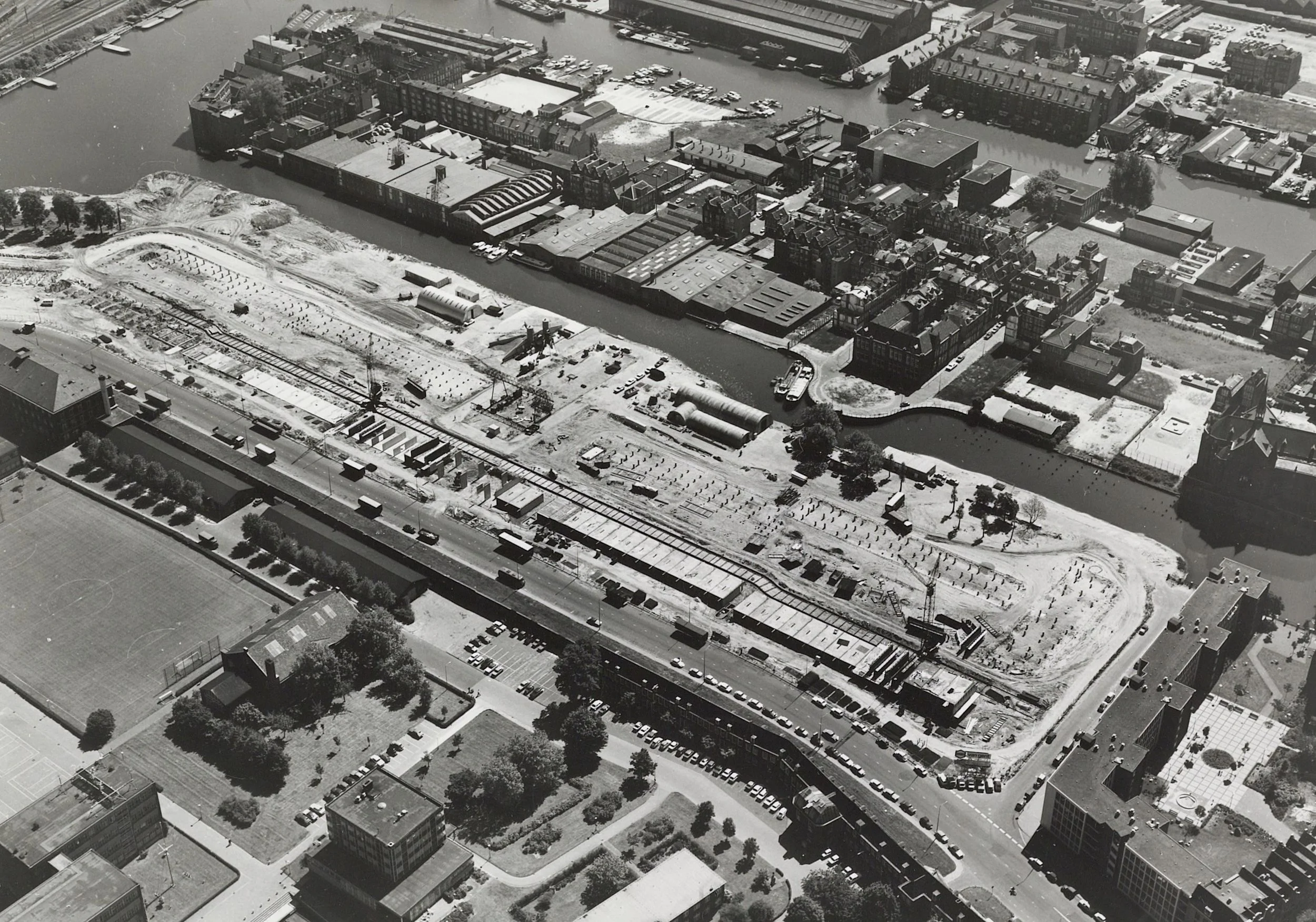
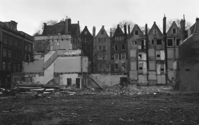
Kattenburg was the first to fall.The Eastern Islands were among the first neighborhoods marked for this new kind of intervention. A 1959 report flagged Kattenburg, Wittenburg, and Oostenburg as areas with severe housing decay — buildings that would soon be declared unfit to live in. By 1969, demolition of Kattenburg was underway. Within a few years, its historic streets and housing were almost entirely gone, cleared to make way for the reconstruction that would define the island's future.
By 1970, the transformation of the Eastern Islands had already begun — the first chapter in a story of demolition, resistance, and rebuilding that would continue for the next three decades.
Amsterdam urban renewal: 1970-1980
By the 1970s, the city began to question its own modernist ambitions. Renewal now meant improving existing neighborhoods, not just building new ones — but demolition continued alongside it, and local residents started pushing back. Jan Schaefer's 1978 appointment to the City Council marked a turning point: buildings were preserved where possible, and replaced with brick construction that respected the old street lines where not. The 1975 Amsterdam 700 celebration captured the shift in mood, with its theme "wonen, werken, spelen" — living, working, playing — signaling a city more interested in human interaction than in separating functions.
On Kattenburg, newconstruction rose quickly through the 1970s, but not without controversy — the historicist facades rebuilt on Kattenburgerplein were criticized by historians as a falsification of the past. Displaced residents, meanwhile, fought to return: rent protests, squatted homes, and occupied offices eventually won most islanders their place back. A monument on Kattenburg today honors that history of resistance.
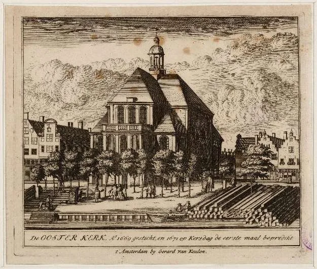
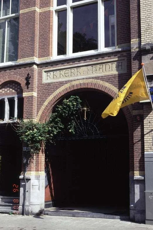
Wittenburg was demolished too, but its central axis survived. Not every historic building did: St Anne's Church was torn down, while the 17th-century Oosterkerk was saved only after residents opposed its planned demolition, reopening in 1985 after years of decay.
Homes declared uninhabitable on Kattenburg, 1965/1970 ©Stadsarchief Amsterdam
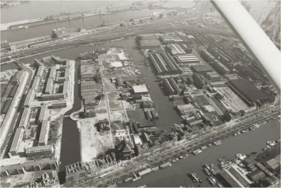
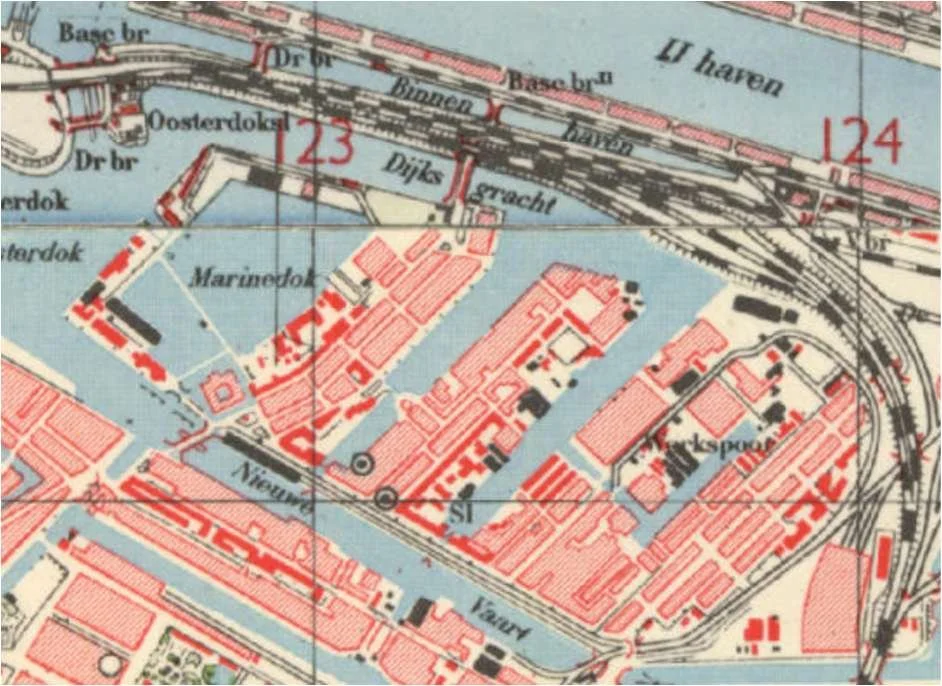
Eastern Islands in 1950 © TOP25 | topotijdreis
Amsterdam city renewal: 1980-2000
By 1980, Amsterdam's population had shrunk for decades, and planners concluded that renewal focused solely on low-income housing had weakened the city's economy. A new "compact city" model took hold — growth within the existing city rather than expansion outward — paired with a stronger emphasis on social renewal and neighborhood-level engagement.
By 1990, Wittenburg's southern half had reached the layout it still has today, its density reduced by leaving the central axis open as public space — a design that drew directly on the island's historic zoning. The Vierwindenhuis, built in 1990, exemplified this era's experimentation: 89 owner-occupied homes sharing a winter garden, café, and theater, all managed by residents.
Oostenburg took a different path. As Werkspoor's rail activity ended in 1989, the island's southern housing was demolished while its industrial buildings in the north were preserved. Redevelopment there continues today, guided by a masterplan that aims for density without losing human scale.
Eastern Islands: today
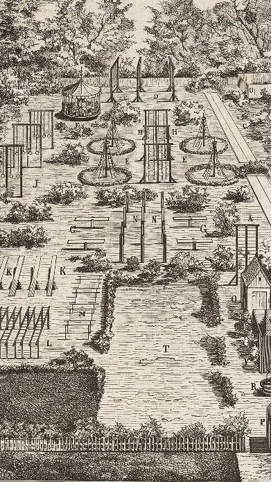
Openbare Speeltuin N.1, Tweede Weteringplantsoen, 1879. ©Stadsarchief Amsterdam
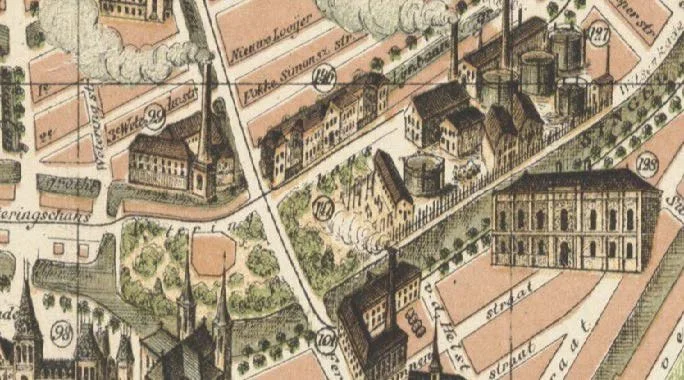
Close up of the second edition of the illustrated map of Amsterdam, scale of 1:10,500, made by Stemler J., Johan G., Gebroeders Braakensiek, 1886-1887. ©Stadsarchief Amsterdam.
Looking across the three islands now, history survives unevenly. Kattenburg's original fabric — shipyards on the edges, housing at its center — was almost entirely erased; little of its historic structure remains legible. Wittenburg tells a different story: even where buildings were replaced, its street pattern and spatial logic still shape how the neighborhood feels, a kind of historic skeleton beneath new material. Oostenburg is different again — never organized around small private shipyards like the other two, but around a single industrial giant, its shift from water to rail still visible in the scale and grain of what's being built there now.
Together, the three islands show how differently a city can carry its past forward — sometimes erasing it, sometimes preserving its outline, and sometimes building new grandeur in dialogue with what came before.
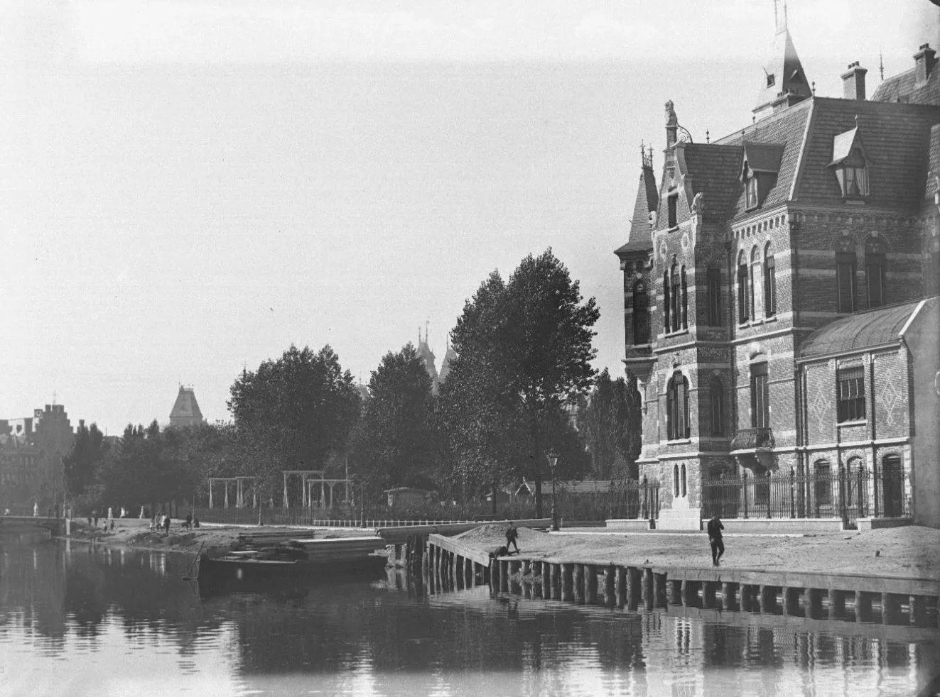
The first public playground on the left, viewed in a westerly direction from Stadhouderskade across the Singelgracht, Jacob Olie, 1891. ©Stadsarchief Amsterdam.
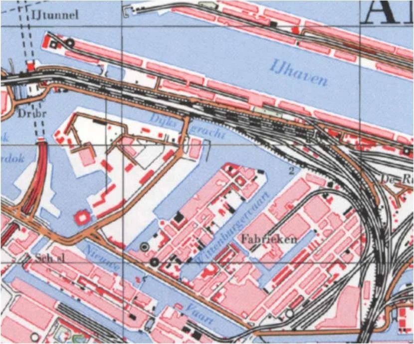
Eastern Islands in 1969 ©TOP25 | topotijdreis
The Openbare Speeltuin N.1 was shaped less by a genuine concern for children's needs than by the social anxieties, moral ideals, and class interests of Amsterdam's bourgeoisie. In daily practice, the playground took on the character of an extension of school rather than a space of free play, with fixed opening times, supervision, and bells marking the start and end of games, leaving little room for children's imagination or self-directed play. It was, above all, a solution conceived from adults' needs and addressed to adults' vision of a well-disciplined society, deepening rather than easing the marginalisation of children within the urban fabric. And yet, it would be reductive to end on purely critical remarks: over the following decades, the concern for children's wellbeing and the civic impulse to discipline urban youth gradually merged, and the Openbare Speeltuin N.1 remains a significant step in the history of children's urban experience in the Netherlands.
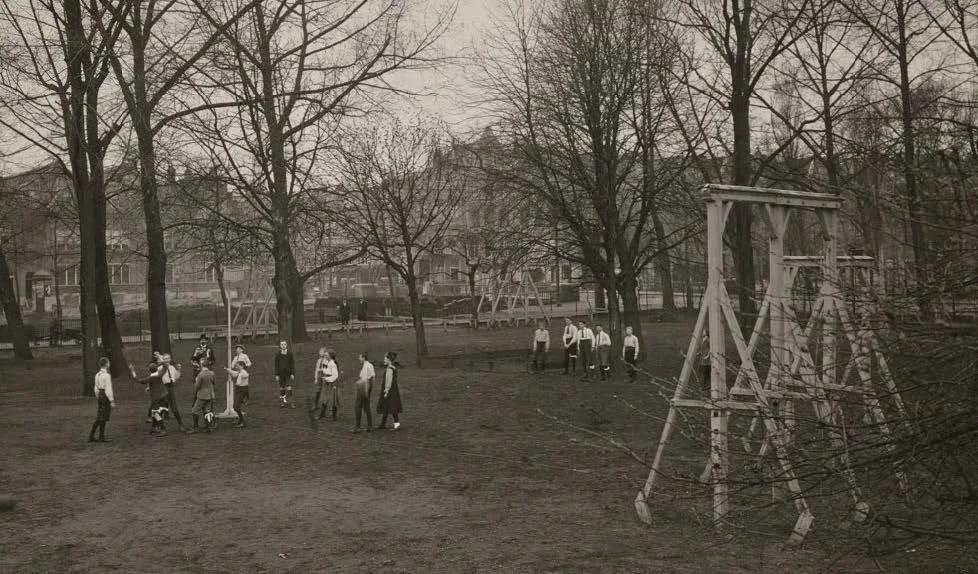
Public Playground No. 1; in the background: Stadshouderkade with Singelgracht. 1900 ca. ©Stadsarchief Amsterdam